This is a worked example. The 3×3 framework is general — it can model a market, a supply chain, a patent portfolio, a theater. The image domain gives us somewhere to test the methodology against ground truth and against frontier LLMs. The five images below were classified by three different approaches. The 3×3 framework got all five right. The frontier models did not.
If you want to see the same framework applied to a strategic question rather than a perceptual one, the Case studies → page shows it in three other settings. The methodology does not change. The input changes.
Why the comparison matters
The test is not about image classification. Image classification is the easiest place to compare a structural approach to a pattern-matching one, because ground truth is unambiguous and the failure modes are visible.
The frontier models in the comparison — ChatGPT 5.2 and Claude Sonnet 4.5 — are remarkable systems. They reason. They generalize. They miss things. The things they miss are the situational and contextual cues that the 3×3 framework is built to make visible.
The pattern is consistent across both frontier models. When the classification depends on a list of object features (texture, color, surface appearance), the LLMs do well. When the classification depends on the interaction of features (atmosphere plus shadow, scale plus weathering, mechanism plus context), the LLMs miss. The 3×3 framework’s structural approach — entities, behaviors, and the emergent properties that arise from their interaction — is what makes that interaction visible.
This is the same advantage that produces a 30-to-90-day lead time on a regime change in a market, a supply chain, or a defense theater. The framework does not see objects. It sees the situation the objects are in. In an image, the situation is the planetary context. In a market, the situation is the structural state the market is sitting in. The methodology is the same.
The error mode, in detail
The most instructive case is image 2 — a Saharan dune with a blue sky. The blue sky is a contextual cue. The dune texture is an object feature. The two combine into a clear Earth classification. A pattern-matching model, looking at the dune alone, sees a Mars-like signature and stops. The 3×3 framework sees the dune, sees the sky, and sees that the interaction of the two is decisive.
Claude Sonnet 4.5 misclassified images 1 and 4 — both cases where the contextual cues (rover hardware, biological desiccation patterns) outweighed the object features. ChatGPT 5.2 misclassified only image 2. Both models relied on object-level reasoning. The 3×3 framework’s structural prior avoided the trap on every image.
For the methodology that produces this advantage, see The 3x3 framework, explained →.
How the 3×3 model helps
We structure the evidence into three layers:
- Entities (O): observable objects and surfaces (regolith, rocks, tracks, shadows)
- Behaviors (B): physical processes shaping them (erosion, sediment flow, compaction, illumination)
- Emergents (e): higher-level cues that appear from interactions (patterning, depth, directionality)
When an image is dominated by mechanism-only evidence and lacks biological or human traces, the model shifts toward a Mars classification. When we see water-weathered surfaces, vegetation patterns, or human scale/context, it shifts toward Earth.
Decision cues used in practice
Typical signals that push the classification toward Mars:
- Dry, fine-grained regolith with uniform dust tones
- Sparse, angular rocks without water-weathering
- Strong, sharp shadows in a thin atmosphere
- Rover-like tracks or hardware shadows without surrounding context
Typical signals that push toward Earth:
- Vegetation or biological texture
- Mixed mineral colors with moisture cues
- Weathering from water or wind (rounded stones, sediment layers)
- Human artifacts or scale references (roads, fences, footprints)
Image set
Summary (all correctly identified):
| Image | Verdict | Primary cue | Link | 3x3 | ChatGPT 5.2 | Claude Sonnet 4.5 |
|---|---|---|---|---|---|---|
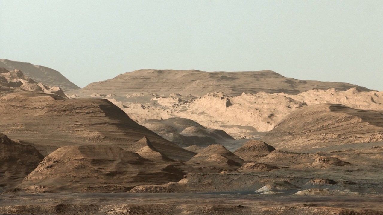 |
Mars | Regolith + rover-like tracks/shadow | View analysis | ✓ | ✓ | ✗ |
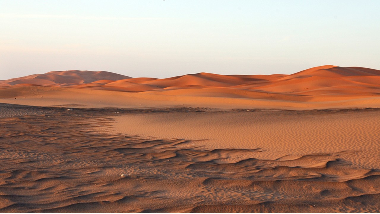 |
Earth | Blue sky + terrestrial dune texture | View analysis | ✓ | ✗ | ✓ |
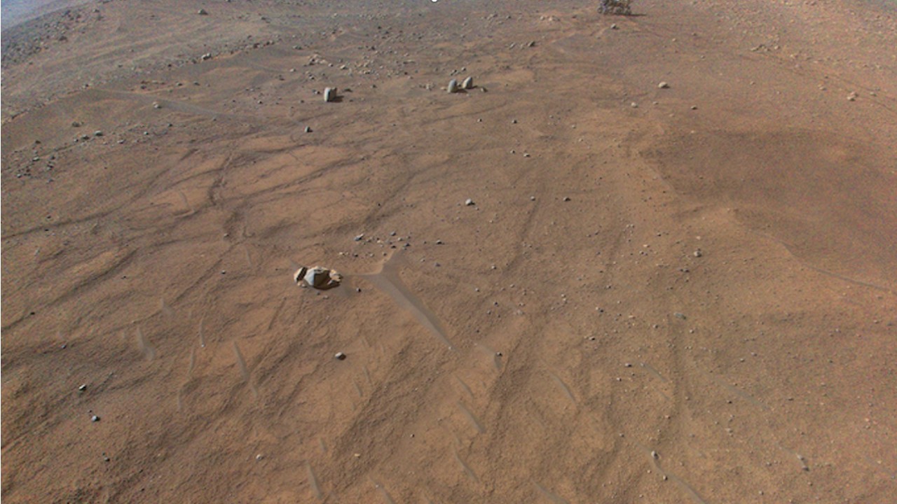 |
Mars | Rover-like shadow + dry regolith | View analysis | ✓ | ✓ | ✓ |
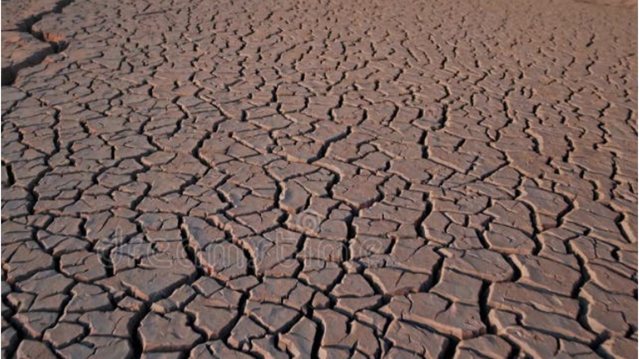 |
Earth | Mudflat desiccation polygons | View analysis | ✓ | ✓ | ✗ |
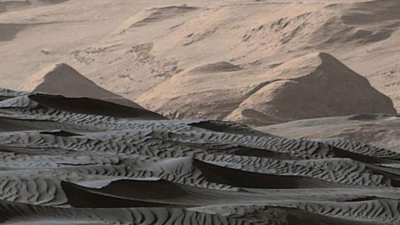 |
Mars | Large dune scale + dry aeolian signature | View analysis | ✓ | ✓ | ✓ |
To see the same framework applied to a strategic question, see the Case studies → page. To start a conversation about your domain, [get in touch →](/contact].